
The other night/evening I took the drone up for a sunset photo, and I sure wasn’t disappointed.

The other night/evening I took the drone up for a sunset photo, and I sure wasn’t disappointed.
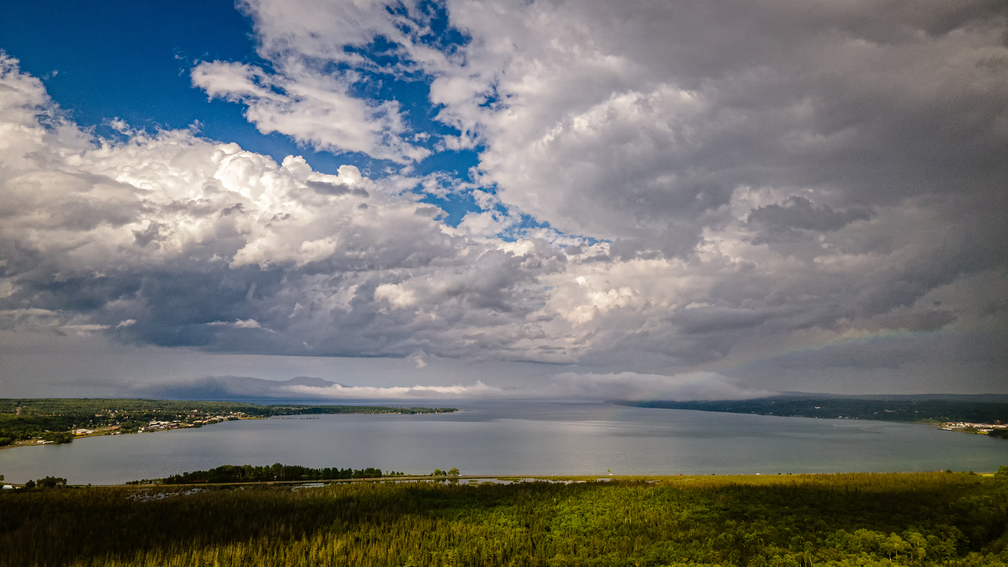
I have always kept an eye on the weather, and knowing there could be some popup storms today I watched the radar most often. A little before 4:00 PM I noticed a few clouds, checked the radar, and sure enough a nice little storm was heading my way. What did I do? I grabbed my drone and headed up into the sky. In one direction, to my southwest, was a storm coming, and in the other direction over Keweenaw Bay, bright sunny skies.
After the storm passed the sun came out, so I grabbed the drone again to hunt for a rainbow. Sure enough, there was one, though not a real strong one but still pretty cool.

Incoming Storm

Keweenaw Bay Before The storm

Rainbow
Keweenaw Bay with a hint of rainbow on the right

Flower from my wildflower patch
Last night I had a hunch the sunset would be good, one because there were some clouds, and two, the smoke from forest fires in the western states. I was not disappointed. There was even a small storm brewing to the south west that I was aware of until I took the drone up and saw it.

Sunset Over Keweenaw Bay

Sunset Over Six Mile Creek Preserve

Sixmile Creek

Something Wicked This Way Comes

Little More Color – Back of Property
Not much has been happening, just work mainly. The other day I tried taking a slow motion video of some Hummingbirds with the drone. I set the drone up on the front deck railing, went back in the house and sat there triggering the drone to record. After splicing and merging all the clips, I ended up with about 30 seconds in real time footage, but taken in 1080p at 240 FPS, it lasts 6 minutes. I’ll have to try this again sometime.
I also took a few different sunset photos with the drone flying up from the house. The first one is about 15 minutes before the second. Both photos are looking across the road from my place. The creek is Six Mile Creek and most the land is Six Mile Creek Preserve, part of the Keweenaw Land Trust. The land around the preserve is DNR land.
More info here…
https://keweenawlandtrust.org/protected-lands/six-mile-creek
Just after landing the drone rain started falling.


Went out to Point Abbaye yesterday, haven’t been out there in 2 years. The place sure is used more now that it has before publicized. I was happy to see you could still drive all the way out to the point, the last section I thought for sure would be blocked off by now.
There was some guy just leaving the spot I was going to, but he stuck around for a few to watch the drone.
A little bit of Autumn color is starting in the far back of the property. Mostly greens brightening up with a little yellow mixed in.

Hot and humid day today, so I hardly even went outside. About 7:30 PM it looked nice out so I flew the drone out for a quick shot of the bay.

Needed to get out of the house yesterday, even if it was hotter than hell outside. I headed out to a couple spots that I thought would be good to fly the drone and get some photos, and for the most part they were.
First stop was out Old US-41 near Alberta where there’s an old camel back bridge that’s no longer in use. I got some pretty good photos of the bridge there. Once home, I was amazed at the detail the little camera on the drone had once zoomed in in Lightroom.
My next stop was near the Sturgeon River Gorge Wilderness Area, I knew of a couple good spots to fly along the river there. I stopped at the first location, flew up and down the river for awhile, and got some video footage. By the time I was finished there, it was getting way too hot to make a stop at the other spot which is right down the road. I’ll be coming back here during autumn colors, it should be really nice with the drone.
I then headed home.
The first group of photos is from the camel back bridge on Old US-41.
The videos are from the Sturgeon River Gorge Wilderness Area.
And lastly, a photo from the other day looking out at Keweenaw Bay which is a 3×3 panorama photo.


